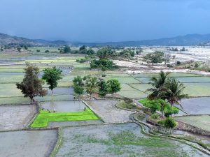
As the wind changes direction and Dili’s afternoons become stickier, you’d be forgiven for wondering when the rain will get here – and perhaps whether we’re set for another dry, desperate El Niño event, like that which wracked Timor-Leste in 2016. But don’t panic.
A Pacific Ocean weather pattern that brings increased rainfall to South America and dry weather to West Pacific Countries, including Timor-Leste, El Niño is a phenomenon occurring every four to five years.
But as the Timor Post reported on Friday, there may be minimal impact of this slight delay in the rainy season’s arrival.
“I want to inform the public not to panic with a long dry season or El Nino in this land, but Timor-Leste is in fact having an El Niño now, but not a strong El Niño,” the National Director for Meteorogology and Geophysics, Terencio F Moniz, told the newspaper.
Describing the weather pattern as a “weak El Niño”, the director said it was having a minimal impact on rainfall. There is good information available on the impacts of El Niño of rainfall across Timor-Leste, collated in 2012 climate maps prepared by the Australian-funded project and AI-Com’s predecessor, Seeds of Life.
The weather maps show rainfall in key areas of each of Timor-Leste’s 13 municipalities, compare rainfall during El Niño, rainfall-heavy La Niña, and usual weather patterns, explain variance between seasons, and offer suggestions of crops to plant during particular weather patterns.
So no need to worry – it might feel uncomfortable, but the relief of rain will soon arrive.